Dongbaek Island: The Hidden Park Next to Haeundae
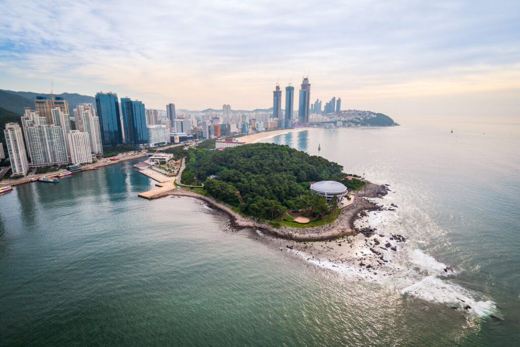
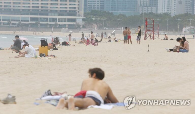
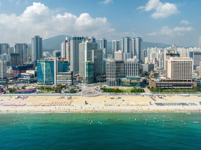
If you’re at Haeundae Beach, Dongbaek Island Haeundae is sitting right there at the western end — a small forested peninsula that most visitors walk straight past on their way to the sand. I’ve done this loop more times than I can count, usually before 9am when the paths are empty. Free entry. About an hour if you take your time. And the views of Gwangalli Bridge (광안대교) from the far tip are the best you’ll get without dealing with the crowds at Gwangalli itself.
What Is Dongbaek Island?
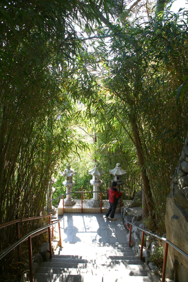
Dongbaek (동백섬) means “camellia island” — named after the camellia trees (동백나무, dongbaek-namu) that blanket the hillside. Technically it’s not an island anymore; it was cut off by water centuries ago but is now connected to the mainland. The whole area sits at the western end of Haeundae Beach and feels completely separate from the crowded strip behind you. Which is exactly the point.
The main things here:
- A 1.2km forested walking loop around the peninsula
- APEC Naru Park (APEC 나루공원) — the open grassy area at the base of the hill
- Nurimaru APEC House (누리마루 APEC하우스) — the building where world leaders met in 2005
- Views of the Haeundae skyline and Gwangalli Bridge from the southern tip
Admission to everything: free. No ticket booth, no queue, no booking required.
The Walking Path: What to Expect
The loop starts from APEC Naru Park, near the entrance closest to Haeundae Beach. There’s a map board at the trailhead — you probably won’t need it. Most sections are paved; wooden boardwalks run along the coastal edge.
The full loop is about 1.2km and takes 30–40 minutes at an easy pace. Dense camellia and pine forest, occasional benches, a few gentle inclines. Nothing difficult.
A few things to know before you go:
- The path gets slippery after rain — shoes with grip help
- Camellia season runs December through March; the red flowers drop to the forest floor and the whole trail looks different
- Morning visits (before 9am) mean almost no one else on the path
- Dogs are allowed on leash
- There are public toilets near the main entrance and again near Nurimaru
One honest note: the trail is pleasant, not spectacular. If you’re expecting dramatic cliffsides or sweeping panoramas around every corner, you’ll be disappointed. The value here is the shade, the quiet, and the one genuinely good view at the far end — not the walk itself. Know that going in.
If you’re navigating by phone, Naver Map is more reliable than Google Maps here — search 동백섬 and it drops a pin at the main entrance. Google often misses the internal trail paths.
Nurimaru APEC House
At the far tip of the peninsula sits the Nurimaru APEC House (누리마루 APEC하우스). Nuri (누리) means “world” and maru (마루) means “peak” or “top” — the name was coined for the 2005 APEC summit Busan hosted. George W. Bush, Hu Jintao, and Vladimir Putin all had meetings in this building. The architecture is modeled on a traditional Korean hilltop pavilion (정자, jeong-ja), with floor-to-ceiling windows facing the sea on three sides.
You can walk through the conference rooms, kept close to their 2005 configuration. There’s a small exhibition about the summit and a gift shop near the entrance. Most people spend 15–20 minutes inside, then linger on the outdoor terrace.
| Detail | Info |
|---|---|
| Hours | Tuesday–Sunday, around 9:00am–6:00pm (last entry 5:30pm) |
| Closed | Mondays (and some public holidays) |
| Admission | Free |
| Address | 동백로 116, 해운대구, 부산 (116 Dongbaek-ro, Haeundae-gu) |
Hours were accurate as of early 2026 — closure dates around public holidays can shift, so it’s worth confirming before you make the trip specifically for Nurimaru.
Find Nurimaru APEC House on Naver Map.
Best Photo Spots
The southern tip gives you the cleanest view of Gwangalli Bridge — the cable-stayed suspension bridge (광안대교, Gwangalli Daegyo) that stretches across the bay between Suyeong and Nam-gu. During the day it’s a long, clear shot across flat water. At night the bridge is lit in different colors, and if the sea is calm you get a decent reflection. No crowds, no entry fee — just a bench and the view.
The other shot worth planning for is looking east toward Haeundae from the coastal boardwalk. You get the full curve of the beach with high-rise hotels stacked behind it. Early morning with eastern light works best; overcast days are fine too — the sky won’t blow out.
Three specific stops on the loop:
- The southern rocky outcrop — halfway around on the sea-facing side. Best angle for the bridge shot. A few benches here.
- Nurimaru terrace — elevated and facing south. Wide angle works well; on clear days you can make out the faint outline of the Oryukdo islands (오륙도).
- APEC Naru Park lawn — back at the base, looking east toward the beach. Works well at golden hour.
Getting There
The island is attached to the western end of Haeundae Beach. From Haeundae Station (해운대역) on Busan Subway Line 2, take Exit 5 and walk toward the beach. When you reach the sand, turn right (west) and follow the beachfront path for about 10 minutes — you’ll see the forested hill rising at the end of the beach and the APEC Naru Park entrance sign.
If you’re using the Busan subway with a T-money card, this whole trip is one fare from central Busan. There is parking near the entrance, but it fills quickly on weekends and summer afternoons.
You can also search 동백섬 부산 on Naver Map for walking or transit directions from your starting point.
What to Combine It With
Dongbaek Island pairs well with a morning at the beach or an afternoon wander through the area behind it. If you’re spending more time in Haeundae, the full Haeundae Beach guide covers the market, the jimjilbang (찜질방, jjimjilbang, Korean sauna), and where to eat on the strip.
Come for the walk, the shade, and the Gwangalli Bridge view. That’s what it does well — and it does all of it for free, without any planning. Just show up.
Last verified: April 2026 · Sources: Visit Busan, Naver Map – Nurimaru APEC House
Prices, hours, and details change frequently. Please verify on the official website before visiting.